


 A picture taken June 22 into the one crater that remained active until the end of the eruption that began on May 29. (Photo: Civil Defense)
Another diking event and/or eruption is likely to occur in the coming weeks or months.
Around 20 earthquakes have been measured in the area of the unrest during last week, the largest of magnitude M1.3 occurred west of Grindavík. The level of seismicity is overall unchanged over the past two weeks.
Around 260 earthquakes were detected on the Reykjanes peninsula during last week. Around 60 earthquakes occurred in the Lambafell mountains at Þrengsli. Around 10 occurred in Brennisteinsfjöll. 100 earthquakes were located in the surroundings of lake Kleifarvatn, about 40 were east of the lake and the remaining were west and southwest of it and around the geothermal area of Seltún. 40 earthquakes occurred in Fagradalsfjall, all below M1.0 and most of them at a depth of 7-10 km. Around 20 earthquakes were detected at Reykjanestá, the tip of the Reykjanes peninsula, and around 20 were located in the Reykjanes ridge, ca. 90 km offshore southwest of Iceland.
GPS measurements show that the uplift underneath the Svartsengi area continues at similar rate as in the past days. The deformation pattern shown by Sentinel-1 satellite images, covering the period 25 June – 7 July, agrees well with these measurements. The results from geodetic modeling show furthermore that the magma inflow is now higher than before the eruption which commenced on 29 May. This data suggests that the timeline for another diking event and/or eruption is expected to be within weeks or months.
The hazard map has been updated and it is valid until 16 July assuming no changes in the activity. The hazard map is mainly unchanged except for Zone 1 (Svartsengi) where the hazard for lava flow invasion has been lowered. The hazard level for this area is therefore reduced from considerable (orange) to moderate (yellow). The hazard for lava flow invasion in Zone 6 has also been lowered.


www.malaymail.com/news/world/2026/01/11/bomb-attac…
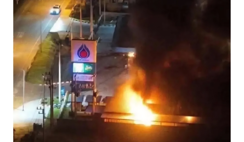
BANGKOK, Jan 11 — A series of late-night bomb attacks targeted 11 PTT petrol stations in Thailand’s southern border provinces of Narathiwat, Pattani and Yala…
www.khaama.com/at-least-eight-refugees-die-37-resc…

At least eight refugees died and 37 were rescued when their boat sank off Badmeli near Izmir, Turkish authorities said on Saturday.
katu.com/news/local/oregon-confirms-first-measles-…

Health officials in Oregon have confirmed the state's first measles cases of 2026, with two people diagnosed in Linn County.
abc11.com/post/measles-north-carolina-state-report…

Measles in North Carolina: State reports 5th case linked to South Carolina surge