


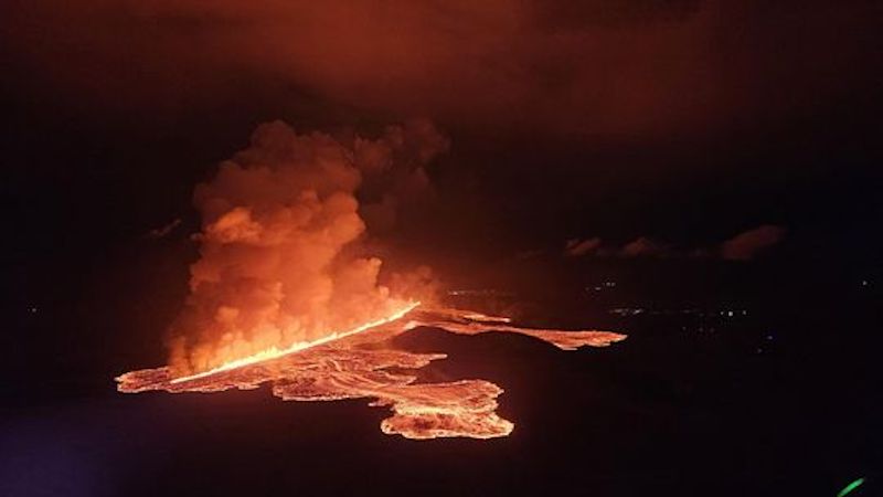
 Volcanic eruption started at Sundhnúks crater row at 21:26 UTC tonight, 22 August. This photo is taken one hour after the eruption started and the eruption fracture is estimated approximately 4 km long. Photo: Björn Oddsson/Civil Protection.
The eruption has significantly weakened
Updated 5. September at 15:00 UTC
The intensity of the eruption continues to weaken
GPS measurements indicate that uplift at Svartsengi has resumed
Southwesterly winds are present at the eruption site, with a speed of 13-20 m/s. Air pollution from volcanic gas may be detected in Vatnsleysa and the capital area
The hazard assessment remains mostly unchanged
The activity of the eruption has continued to decrease in recent days. However, two eruptive vents still appear to be active. The lava field north of the eruption site continues to thicken and expand slowly to the north. At this point, the active lava flow does not threaten infrastructure near the eruption site. Furthermore, changes in volcanic tremor and gas emissions indicate that the eruption has diminished significantly in recent days.
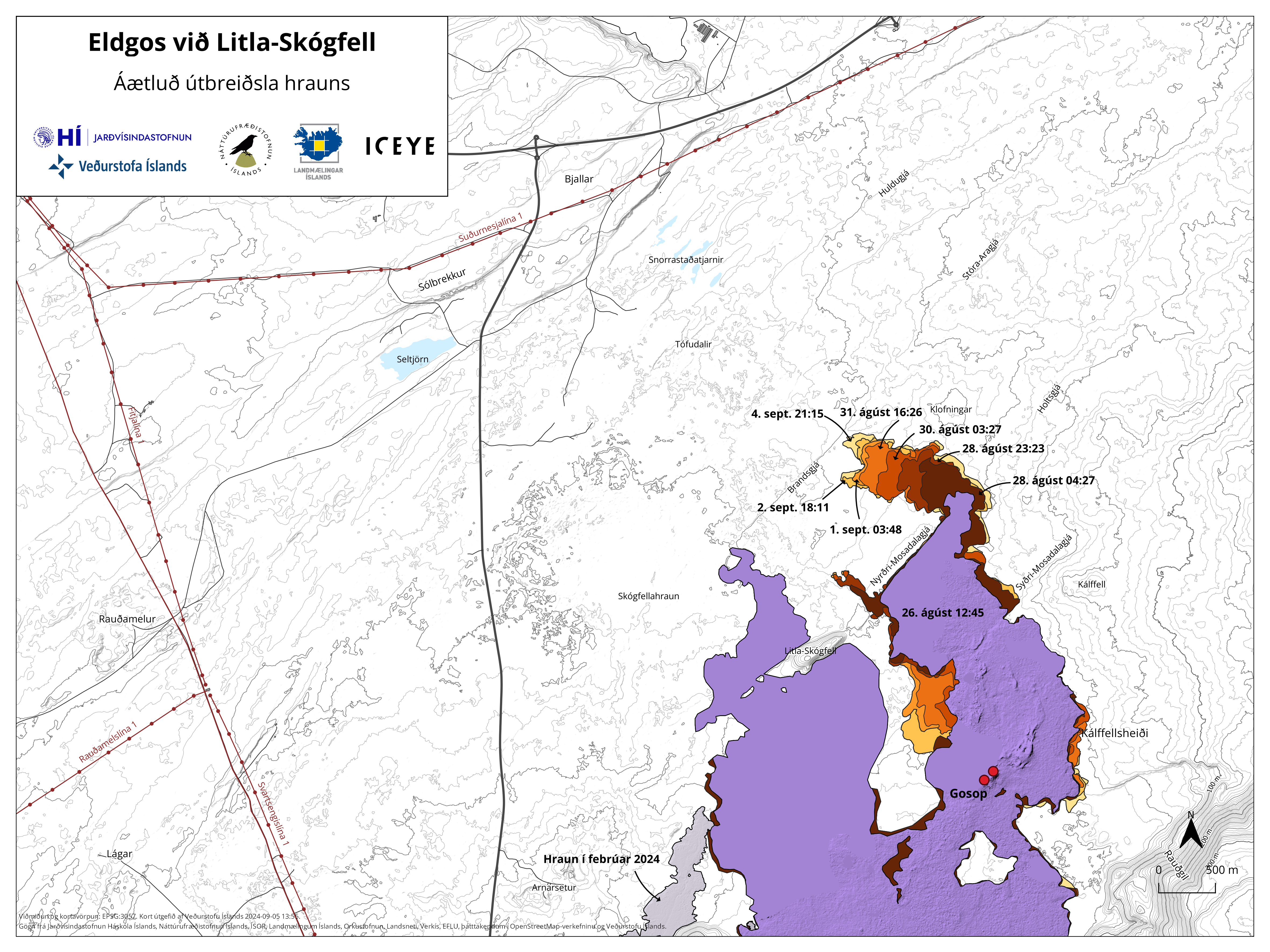 A map showing the actively expanding part of the lava field that formed during this eruption. The map is based on data from the Iceye satellite.
GPS measurements suggest that ground uplift has started again in Svartsengi. Meanwhile, the amount of lava extruded in the eruption at the Sundhnúkur crater row has decreased. This suggests that the influx of magma into the reservoir beneath Svartsengi is greater than the outflow from the surface eruption. This development is similar to what was observed after the last eruption began on May 29. In that instance, the uplift at Svartsengi became noticeable approximately two weeks after the eruption started.
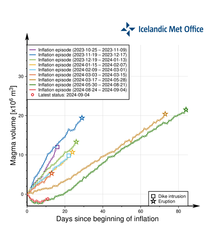 Graph showing the estimated amount of magma that has accumulated beneath Svartsengi between the series of eruptions and intrusions that have been ongoing since November 2023. The green line shows the development of magma accumulation between the last two eruptions. The red line shows the development of magma accumulation after the current eruption began, following a very similar pattern to the green line.
Gas pollution from the eruption is expected to travel north and northeast and may be detected in Vatnsleysa and the capital area.
Seismic activity has slowed since the eruption began on August 22. In recent days, the activity has decreased further, with very little earthquake activity recorded. However, strong winds can affect the sensitivity of the seismic monitoring system, preventing small earthquakes from being detected.
The hazard assessment remains mostly unchanged, except that the risk from volcanic ash is now considered lower. The map is valid until September 10, barring any changes.
 (Click on the map to make it larger)

www.malaymail.com/news/world/2026/01/11/bomb-attac…
BANGKOK, Jan 11 — A series of late-night bomb attacks targeted 11 PTT petrol stations in Thailand’s southern border provinces of Narathiwat, Pattani and Yala…
www.khaama.com/at-least-eight-refugees-die-37-resc…

At least eight refugees died and 37 were rescued when their boat sank off Badmeli near Izmir, Turkish authorities said on Saturday.
katu.com/news/local/oregon-confirms-first-measles-…

Health officials in Oregon have confirmed the state's first measles cases of 2026, with two people diagnosed in Linn County.
abc11.com/post/measles-north-carolina-state-report…

Measles in North Carolina: State reports 5th case linked to South Carolina surge